

By Sonam Rinzin, Newcastle University
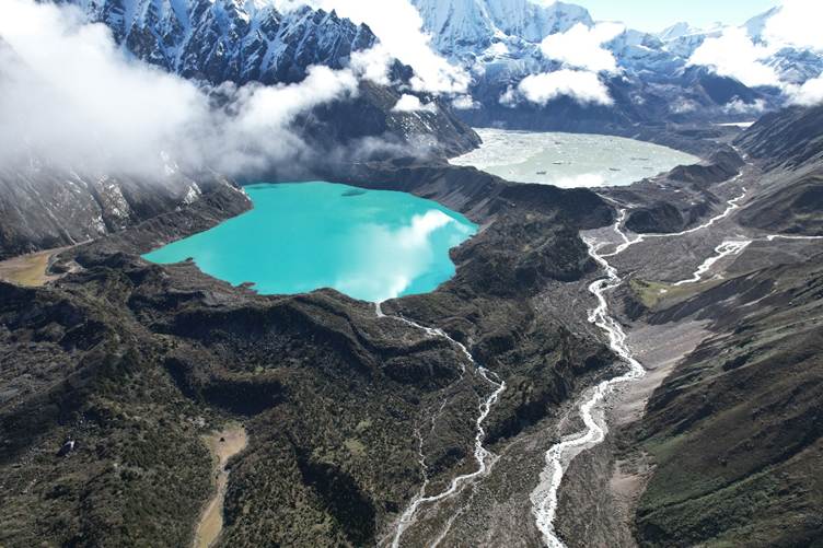
In the remote Himalayan community of Lunana in northern Bhutan, a warning of an approaching glacial lake outburst flood (GLOF) does not always begin with a siren or an official message. It may begin with the sound of the river. GLOF is a rapid and devastating flood that happens when natural dam that holds the lake breaks.
Some residents describe an unusually loud and prolonged roar from the valley. Others recall ground vibrations. Then phones begin to ring as friends, relatives and neighbours pass warnings from one settlement to another.
These experiences from recent GLOFs in 2019 and 2023 reveal an important lesson about how people receive information, whether they trust it, how quickly they act, and whether they are prepared to evacuate.
With support from the Royal Geographical Society’s Frederick Soddy Postgraduate Award, my research explored these human dimensions of GLOF risk in Lunana, one of Bhutan’s most remote and at-risk communities.
Living downstream of glacial lakes
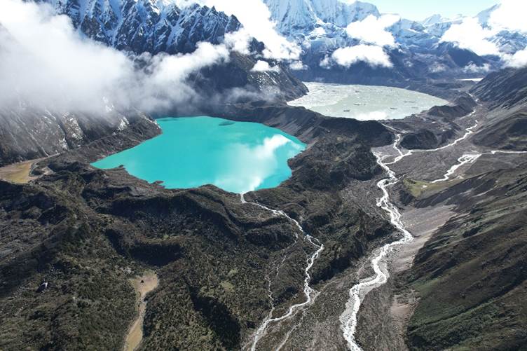
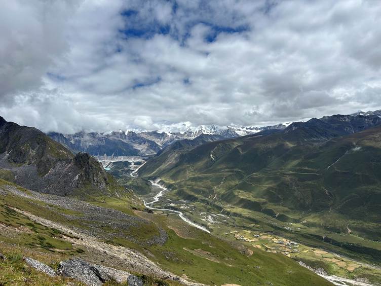
Lunana lies beneath some of Bhutan’s largest and potentially most dangerous glacial lakes, including Thorthormi Tsho. The community has been threatened by repeated GLOFs for over 30 years.
In 1994, Lugge Tsho burst its moraine dam, sending a destructive and deadly flood downstream through the Phochu valley, claiming dozens of lives, including those from Lunana. Smaller GLOFs from the Thorthormi lake system in 2019 and 2023 again forced residents to respond to rapidly developing flood threats.
These events provided an unusual opportunity to understand warning and evacuation from the perspective of people who have experienced them.
I therefore asked:
How did people first know that something was wrong? Who warned them? What did they do before evacuating? And how prepared would they be if another GLOF occurred tomorrow?
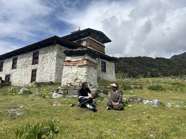
To investigate this, I surveyed 101 households across the communities of Thanza-Toenchey, Tshozhong and Lhedi, covering approximately three-quarters of households considered to be at GLOF risk in Lunana. This was followed by focus-group discussions and interviews with farmers, senior citizens, monks, public servants and other community members.
Importance of informal warning
One of the clearest findings was the importance of informal warning.
For around 37% of respondents, the first indication of a GLOF came from environmental cues, particularly the prolonged roaring sound of the river and ground vibration. Another 32% first received information through mobile phone calls, with neighbours, friends and family members forming an important part of the warning system.
This finding is particularly relevant in remote mountain environments, where settlements are dispersed, and monitoring and communication infrastructure can be vulnerable to extreme environmental conditions. Someone upstream may see or hear the flood first, and telephone relatives farther downstream, allowing information to move through the valley ahead of the flood. This shows the real value of local environmental knowledge.
But relying too heavily on these cues does come with caveats. Some residents described physically checking the river to confirm the flood both before and after evacuation. During a rapidly evolving GLOF, such behaviour can unnecessarily expose people to hazard.
The lesson is not that environmental knowledge should replace technology. Rather, local knowledge and technological monitoring should complement each other.
Knowing the risk is not the same as being prepared
Lunana residents demonstrate remarkably high awareness of GLOF risk. Among people who were present during the 2019 or 2023 events, around 95% evacuated, usually towards higher ground.
Previous experience undoubtedly matters. Memories of the destructive 1994 GLOF, which killed ~23 people and destroyed dozens of buildings along the river corridor, remain strong, while government awareness programmes and engagement with scientists have reinforced understanding of the hazard.
Yet my research exposed an important distinction between risk awareness and practical preparedness.
People may understand clearly that a GLOF is dangerous and know where to evacuate, but that does not necessarily mean they are ready to leave quickly.
Residents describe recent evacuations as chaotic and poorly coordinated. In the rush to reach safety, some left without basic items such as footwear, blankets, adequate warm clothing or other emergency kits.
What happens after people reach safety?
Many designated evacuation areas are exposed, high-elevation grounds. During previous evacuations, residents sometimes remained outside overnight, relying on fires and blankets to keep warm.
In a Himalayan mountain environment, particularly at night or during poor weather, prolonged exposure can itself become hazardous. Older residents, young children and people with mobility difficulties may be especially vulnerable.
An early warning system should therefore not be judged solely by whether people receive a warning before the flood arrives. We also need to ask: Where do they go? How long can they remain there? Do they have shelter, communications, food, warm clothing and other essential supplies?
Permanent or semi-permanent shelters at key evacuation sites could substantially improve preparedness. These could contain basic emergency supplies and resilient communication equipment, including satellite communication where conventional networks may fail.
Simple household measures could also make an important difference. A prepared “grab-and-go” bag containing essential clothing, medicines, identification documents, a torch and other necessities would reduce the number of decisions people need to make during the few minutes available for evacuation.
Regular evacuation drills could turn awareness into practised behaviour.
Building warning systems around people
Interestingly, the study found strong trust in formal institutions. When respondents were asked where they would trust information about a future GLOF, 81% identified Bhutan’s National Centre for Hydrology and Meteorology (NCHM) as a reliable source.
But when asked how they preferred to receive information, mobile phone calls were the most trusted communication channel, selected by around 72%.
These findings suggest that we should not think of formal and informal warning systems as competing approaches.
An official warning from NCHM might travel through automated systems, local government officials, community leaders, teachers and mobile phones before ultimately reaching individual households. Friends and relatives may then spread that warning further.
A stronger warning system would deliberately incorporate these networks while maintaining a clear authoritative source.
Redundancy is particularly important. No community should depend on a single sensor, siren or communication channel. Extreme floods can damage the very infrastructure designed to detect them. Combining monitoring technology with mobile communications, community networks and local environmental observations provides several possible pathways for a warning to reach people.
Livelihood concern
Early warning can help people escape, but it cannot move their houses, livestock, crops or other livelihood assets out of the floodplain.
For communities living with repeated GLOF threats, resilience therefore extends beyond evacuation. People must also consider what happens if their homes or livelihoods are destroyed, and whether relocation to safer areas is socially and economically realistic.
This brings us back to why geography matters to disaster risk.
GLOFs are physical processes originating high in glaciated mountain catchments, but disasters emerge from the interaction between those physical processes and the places, livelihoods, infrastructure and communities downstream. Understanding flood depth, velocity and arrival time is essential, but these parameters alone cannot explain why some people receive warnings earlier than others, why some evacuate more quickly, or why surviving the flood may still lead to substantial long-term loss.
Next generation GLOF early warning systems need to put communities much more firmly at their centre.
Read the full article from the International Journal of Disaster Risk Reduction.
About the author: Sonam Rinzin is a final year PhD student at Newcastle University, UK. Sonam’s research interest include glacial change and downstream risk assessment in the Himalaya. Sonam’s PhD include glacial hazard and risk to life assessment in Bhutan using computer modelling.
Suggested further reading
Rinzin, S. et al. (2026). Public warning and evacuation experiences during recent GLOF events (2019 and 2023) and recommendations for future preparedness: Insights from Lunana, Bhutan. International Journal of Disaster Risk Reduction. Available from: https://doi.org/10.1016/j.ijdrr.2026.106211
Sahana, M., Areendran, G., Sivadas, A., Masroor, M., Abhijita, C.S., Raj, K. et al. (2025). A mixed-methods approach for identifying high conservation value areas in the high-altitude landscapes of the Indian Himalayan region. Geo: Geography and Environment. Available from: https://doi.org/10.1002/geo2.70002
How to cite
Rinzin, S. (2026, October) When the mountains warn: What Lunana can teach us about glacial lake outburst flood early warning. Geography Directions. https://doi.org/10.55203/CZBU3073

