
By Benjamin Sacks
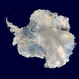
On 18 December 2012, William Hague, the Secretary of State for Foreign and Commonwealth Affairs, announced that the southern portion of the British Antarctic Territory, spanning from the southern edges of the Ronne Ice Shelf to the South Pole, had been renamed in honour of Queen Elizabeth II. In celebration of the Diamond Jubilee, the 169,000 square mile, unpopulated region is twice the United Kingdom’s land area. There is considerable precedent for ceremoniously naming parts of Antarctica. Britain had previously named the the region near the Dumont d’Urville Sea George V Land, and Princess Elizabeth Land near Prydz Bay and the Amery Ice Shelf. Norway, which along with Britain was the chief explorer of Antarctica in the early twentieth century, named a large swath of the continent after its monarchs.
The legal framework behind Britain’s decision to rename a portion of its Antarctic territory is, to pardon the pun, ‘frozen’. Britain’s claim to much of West Antarctica is, like the claims of six other states, held in permanent limbo under the terms of Antarctic Treaty, safeguarding the continent against future development, which became active on 23 June 1961. As such, although Britain, Australia, New Zealand, Argentina, Chile, France, and Norway all made territorial claims, their respective holdings are not necessarily recognized by any other state, and all countries are free to conduct scientific research in any part of the continent.
It is important to keep in mind how little the world knew about Antarctica at the beginning of the twentieth century. In June 1963, Griffith Taylor, a surviving member of Robert Scott’s 1910 expedition, wrote in The Geographical Journal of some of the changes international teams had noted since his perilous journey over fifty years previously. Taylor recalled explorers’ differing geographical accounts, particularly over the length and breadth of continental mountain ranges and ice shelves. Other areas, including the Filchner Shelf, were all but unknown in 1910-14. Finally, and somewhat ominously, he predicted, but did not elaborate upon, the continent’s ‘probable disintegration’ (pp. 190-91).
Although uninhabited, Antarctica was long (and, indeed, continues to be) described within a colonial vocabulary. In part, this was because still so little was actually understood about the continent’s interior. In 1951, famed explored Vivian Fuchs described post-war British efforts in the region. The British were not simply exploring Antarctica, but rather a somewhat indeterminate British Antarctica, stretching vaguely down from the Falkland Islands. The maps, including that of Marguerite Bay, took on a creative, even farcical quality normally associated with the faded charts of early exploration (see. p. 402, for example). But Fuchs’ report was also a clear piece of authoritative legitimation, a systematic chronology of British expeditions since 1945 acknowledging the United Kingdom’s Antarctic interests. Successive generations, including the (1984-85) Joint Services expedition, have continued this role to the present.
Griffith Taylor, 1963, Probable Disintegration of Antarctica, The Geographical Journal 129 190-91.
![]() Vivian E Fuchs, 1951, Exploration in British Antarctica, The Geographical Journal 117, 399-419.
Vivian E Fuchs, 1951, Exploration in British Antarctica, The Geographical Journal 117, 399-419.
![]() Chris Furse, 1987, Joint Services Expedition to Brabant Island, Antarctica, 1984/85, The Geographical Journal 153 1-10.
Chris Furse, 1987, Joint Services Expedition to Brabant Island, Antarctica, 1984/85, The Geographical Journal 153 1-10.

UK to name part of Antarctica Queen Elizabeth Land, BBC News, 18 December 2012.
![]() The Antarctic Treaty, National Science Foundation: Office of Polar Programs, accessed 20 December 2012.
The Antarctic Treaty, National Science Foundation: Office of Polar Programs, accessed 20 December 2012.
