
By Rebecca Collins and David McCullough
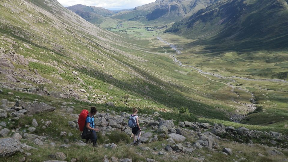
A sunny weekend in Britain sees walkers flocking to areas of outstanding national beauty, eager to enjoy some of the UK’s most beautiful landscapes. Whilst most walkers go prepared with appropriate clothing, footwear, refreshment, and navigational tools, a growing number set out ill-equipped, sometimes finding themselves in danger as a result. This year alone, one group of walkers had to be guided down off Blencathra in the Lake District, having failed to take appropriate navigation equipment, and three separate incidents in Ambleside (also in the Lake District) resulted from members of the public attempting to navigate snow and ice-bound mountain passes. Local mountain rescuers later stated that the only navigational technologies that can provide reliable information about weather conditions are “your eyes and common sense; you can’t blame your sat-nav.”
In an attempt to tackle growing numbers of mountain rescue call-outs by ill-prepared walkers, this summer a team comprised of representatives from the National Trust, Cumbria Constabulary and the Lake District Search and Mountain Rescue Association, questioned all walkers at Wasdale Head as to their preparedness for their journey. Learning more about walkers’ levels of preparation is part of an attempt to ensure the future sustainability of volunteer-run mountain rescue operations, at a time when growing numbers of people depend solely on GPS-based technologies – primarily smartphone apps and in-car sat-nav systems – for everyday navigation. In recent years questions have been asked as to whether over-reliance on these technologies is having a detrimental effect on our innate way-finding ability.
In our recent paper for Area, “‘Are we losing our way?’ Navigational aids, socio-sensory way-finding and the spatial awareness of young adults” we report on an experiment designed to explore the impact of different navigational technologies on way-finding ability and sense of place. The experiment responds directly to the 2012 call by Axon, Speake and Crawford in the same journal for geographers to engage more actively with the potentialities at the intersection of evolving navigational technologies and spatial and cartographic literacy.
The experiment required participants to navigate between two points in a series of towns unknown to them, using a different navigational aid each time. On one route groups used a GPS compatible unit on a smartphone; on a second route they used a paper Ordnance Survey map; and on the third route they were asked to reach the destination with no navigational aids beyond clues in the built and natural environment and their sense of direction. Following completion of these navigational tasks, participants were individually interviewed about their experience of way-finding using these different methods, and they were asked to draw sketch maps showing as much detail of each route as they could remember.
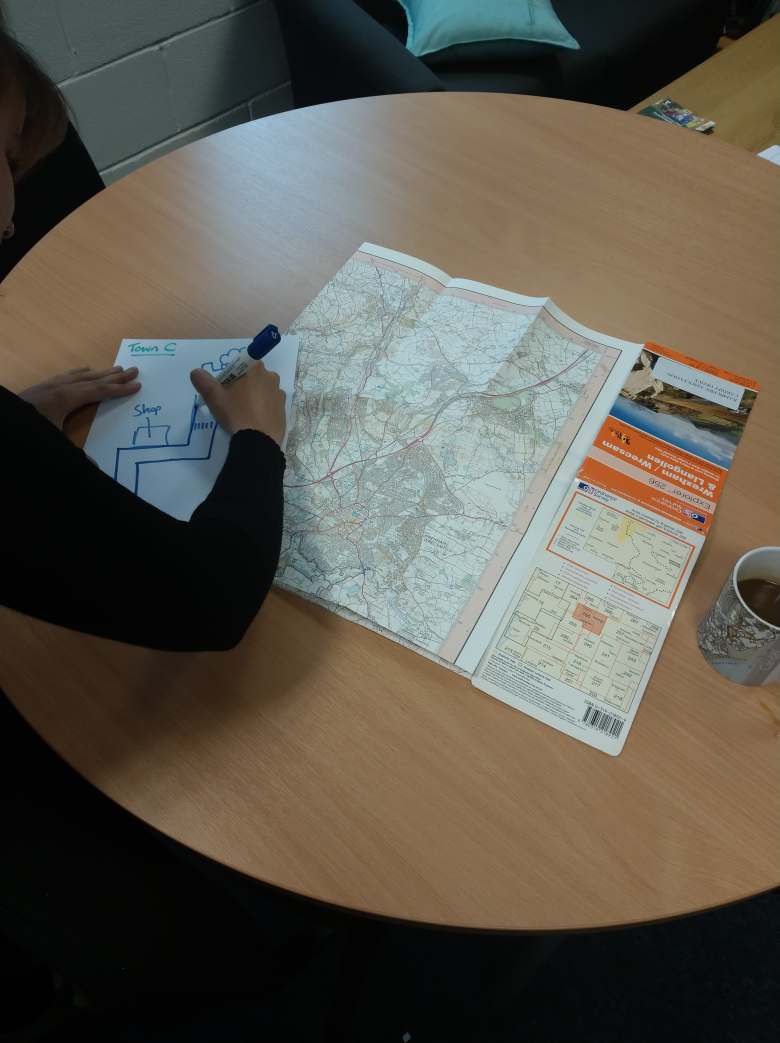
Although all our participants (without exception) claimed that the GPS tool (i.e. a smartphone) was their preferred navigational aid, the routes navigated using it were described overwhelmingly negatively, as “cold” and “boring”, and were characterised by scant recollection of details from the journey, regardless of which route (and town) the GPS was used to navigate. In contrast, the routes navigated using the paper OS map were viewed overwhelmingly positively and were characterised by detailed recollections of the routes, including interactions with people and observations of the natural environment. Despite this, the paper map as a tool was described overwhelmingly negatively, in terms including “not practical”, “out of date” and “hassle”.
Our findings raise interesting questions as to how to strike a balance between the convenience, familiarity, and potential of digital navigational tools and those characteristics of non-digital methods which appear to be better attuned to engendering place attentiveness.
About the authors: Rebecca Collins is Deputy Head of Department and Senior Lecturer at the Department of Geography and International Development, University of Chester. David McCullough is a Department of Geography and International Development, University of Chester alumnus.
References
